

END-OF-YEAR SALE! 6 Months for 99¢Limited-time offer: Gain digital access — from now into 2026. Sale Ends Dec. 28 |
Not all freezes are the same: Advective vs. radiation
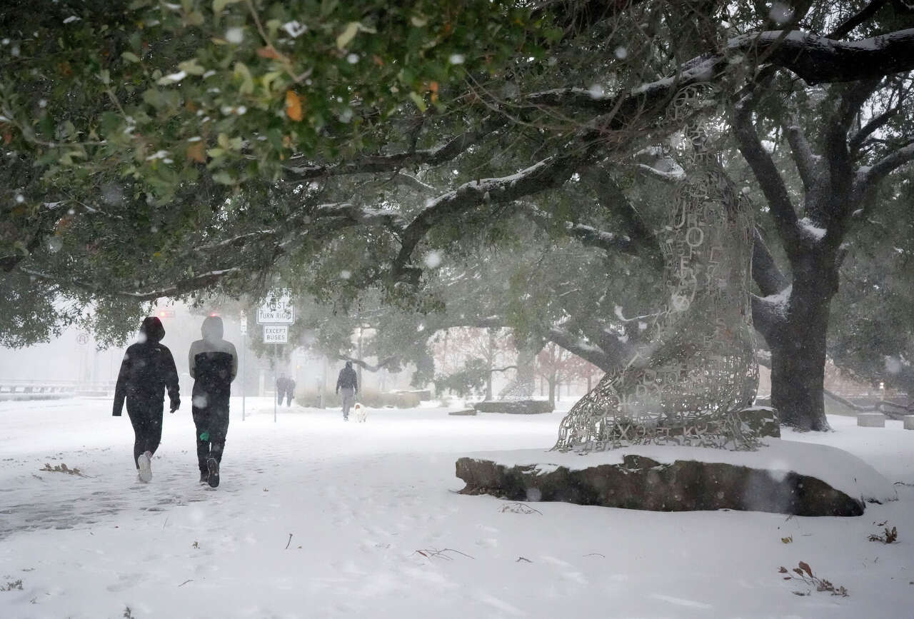
Houston woke up to freezing temperatures Monday, but not all freezes are created equal. Meteorologists generally talk about two types: advective freezes and radiation freezes — and they behave nothing alike.
An advective freeze is the loud, forceful kind that happens when a powerful cold front barrels in, like what we saw over the weekend. It drags bitterly cold air south on strong winds, dropping temperatures fast behind these cold fronts. Wind chills plunge, exposed skin suffers, and even well-wrapped pipes can be at risk because the cold air is constantly being replenished.
A radiation freeze, by contrast, is quiet and sneaky. It settles in on clear, calm nights when heat escapes from the ground into the atmosphere. Winds go still, clouds vanish, and temperatures near the surface drop sharply. Plants, lawns and low-lying areas take the hardest hit, while upper levels stay milder.
Knowing which freeze is on the way can make all the difference and help Houstonians prepare smarter.
You can get weather forecast updates on your mobile phone to learn about the warming trend already on the way. Plus, links now open instantly in our mobile app, so for faster load times and a cleaner user experience, download or update the app here: iPhone | Android.
READ MORE: From flannel to short sleeves, Houston warms up before a front rolls in
 | Justin Ballard, Meteorologist |
Justin's Five Day Fit Check
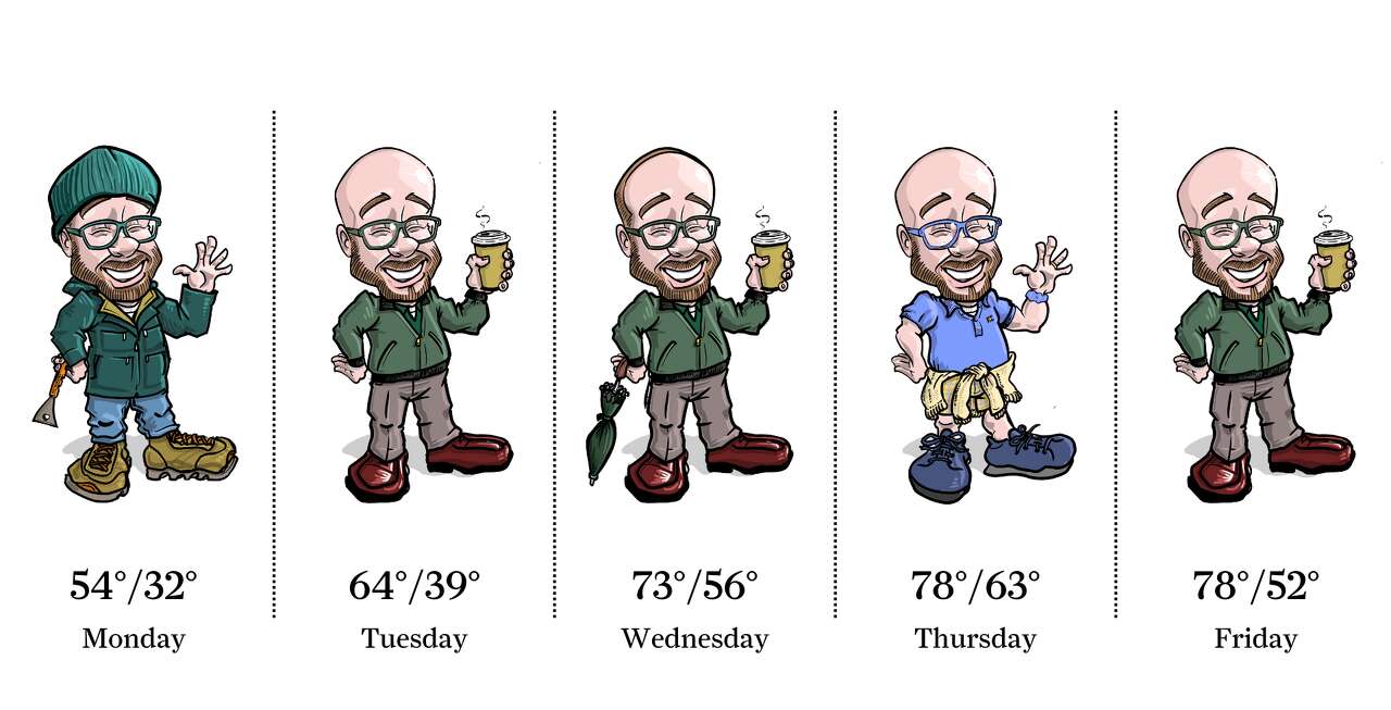
Photo by: Ken Ellis
Welcome to winter, Houston! Well, at least that's how it feels Monday. The week may start on a cold note, but temperatures quickly warm into the mid-60s by Tuesday. We do have some rain chances to contend with, mainly late Tuesday into Wednesday. A dry cold front approaches Houston Thursday, which could take temperatures from near 80 degrees Thursday to the upper 60s by Friday.
| Ask a Meteorologist |
Why does Houston's "official" temperature come from Bush Intercontinental Airport, and should that affect freeze prep? — Angela S.
Houston's official climate observation site moved in 1969 from downtown to the current Bush Intercontinental Airport, about 15 miles north of the city's center.
The shift was driven largely by aviation needs. As Houston's airline industry grew, pressure mounted to concentrate human weather observers at major airports. Maintaining multiple staffed observation sites no longer made financial sense, and the airport became the city's primary reporting location.
Because the move wasn't made for weather or climate reasons, it can complicate the interpretation of data during freezes.
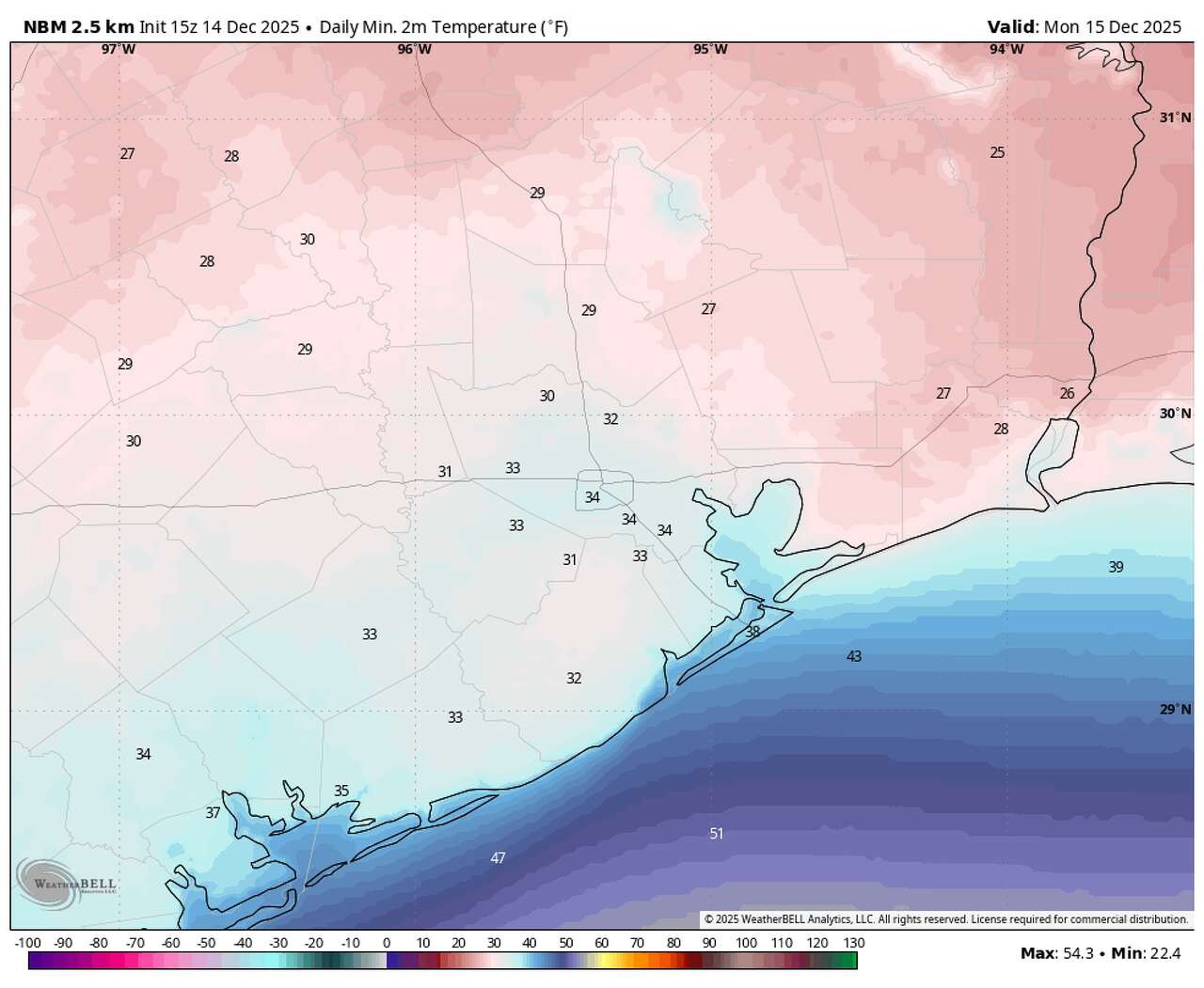
The airport's location matters — especially on cold nights. Bush sits farther north, farther from the Gulf and in a more rural environment than much of the Houston metro area. During clear, calm freezes, it often runs several degrees colder than locations closer to downtown or near Hobby Airport on the city's southeast side. A forecast low of 28 degrees at Bush can easily translate to 32 or 33 degrees near Hobby — the difference between a damaging freeze and a near miss.
That's why freeze prep shouldn't rely on a single number. Checking the forecast for the nearest weather station, and factoring in wind and cloud cover, can make all the difference for protecting plants, pipes and pets.
Do you have a Houston weather or climate question? If so, you can submit your weather questions to justin.ballard@houstonchronicle.com. They may just end up in a future edition of the weather newsletter.
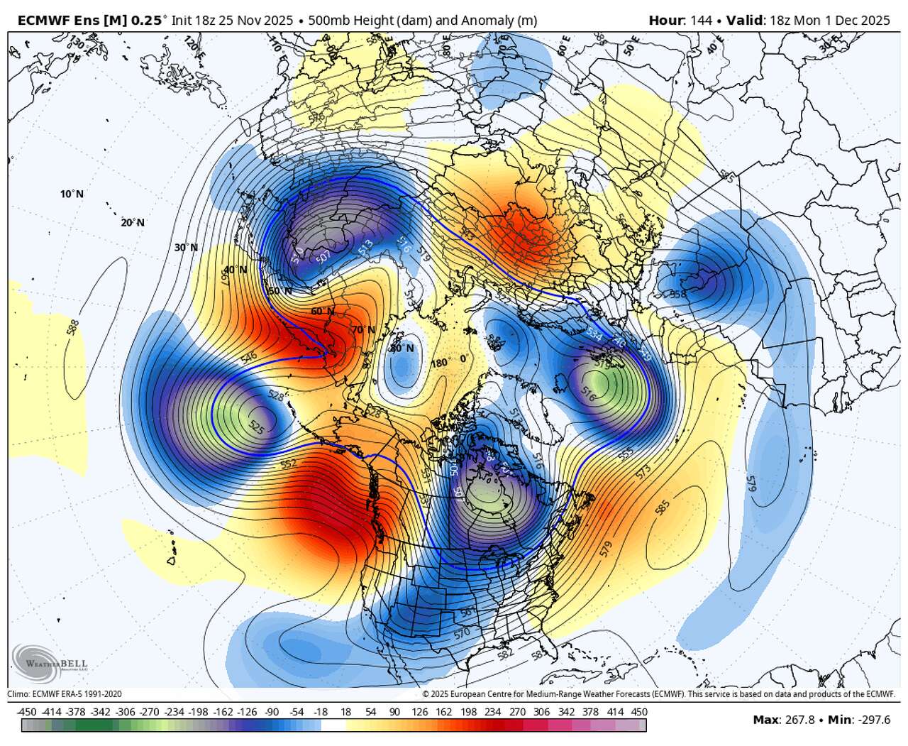
Something to see
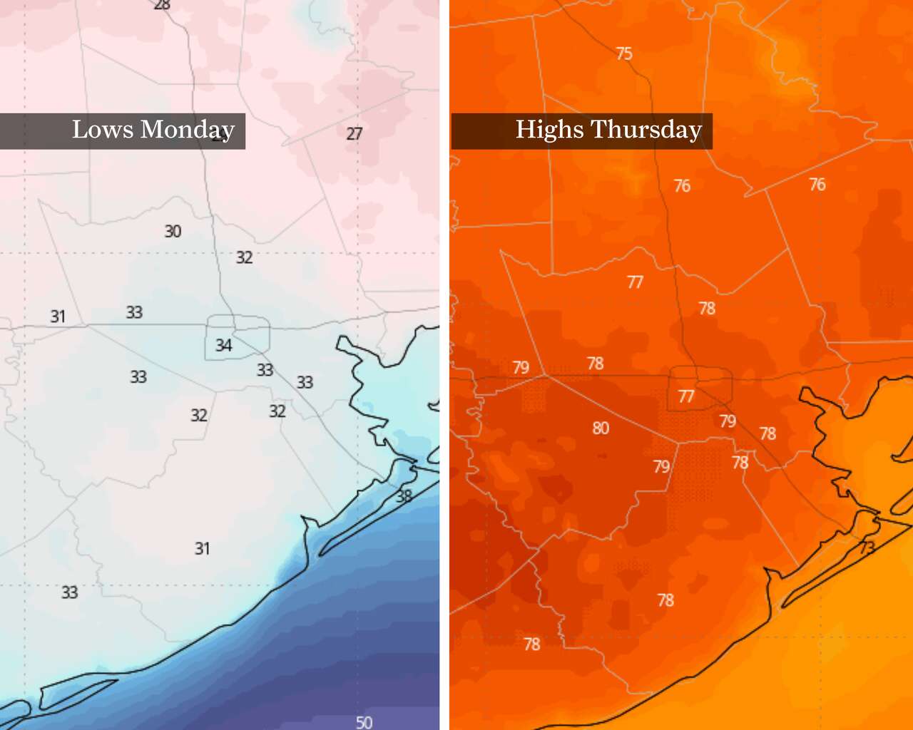
Photo by: WeatherBELL
This image shows just how wild this week's temperature rollercoaster is in the Houston area. From Monday's start near freezing, at left, to highs reaching close to 80 degrees, at right.
Texas Weather Wonks Trivia
Houston normally records its first freeze on Dec. 9, but 1989 brought the earliest temperature of 32 degrees or colder. When was Houston's earliest freeze on record?
A) Oct. 31
B) Oct. 20
C) Oct. 18
D) Oct. 6
Hit reply to this email to let us know what your guess is and a chance to win. We'll let you know who answered correctly first in next week's newsletter.
No one responded correctly to last week's weather trivia question. The coldest early December average high was 52.3 degrees set in what year? C) 1971
Other weather news
|
|
|
|

|
Meet the Team
Photo by: Susan Barber
The 713 Weather Radar newsletter is written and produced by meteorologist Justin Ballard and Texas Weather Science Editor Roberto Villalpando. You can reach out to them at justin.ballard@houstonchronicle.com and roberto.villalpando@houstonchronicle.com or by replying directly to this email.
|
Unsubscribe | Manage Preferences

Houston Chronicle
4747 Southwest Freeway, Houston, TX 77027
© 2025 Hearst Newspapers, LLC


No comments:
Post a Comment