

Get Unlimited Digital Access for 25¢For readers who want more stories, more depth. Sale Ends March 8 |
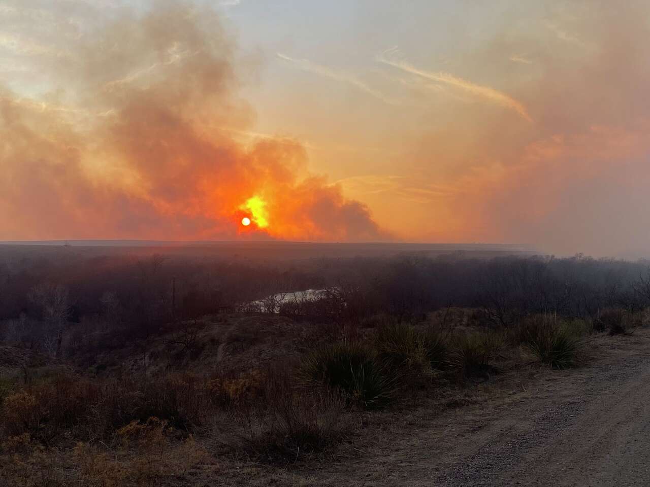
Texas wildfire season has already begun, but here's when the burn threat ramps up
Multiple wildfires broke out last week across the Texas Panhandle, as extreme fire weather conditions gripped the region. Relative humidity dropped to 10-15% from Lubbock to Amarillo, and wind gusts in the area rose to more than 60 to 65 mph, making it easier for wildfires to spread quickly.
The Texas A&M Forest Service responded to nine fires on Feb. 17 alone. The two largest were in the Texas Panhandle: the Lavender Fire in Oldham County and the 8 Ball Fire in Armstrong County. As of Monday, both fires were 100% contained, but more than 18,000 acres have burned in the Lavender Fire and an estimated 13,000 acres have burned in the 8 Ball Fire.
The National Weather Service issues red flag warnings whenever forecasters have a high degree of confidence that critical fire weather conditions are happening or about to happen within the next 24 hours. Newsroom meteorologist Anthony Franze found that the frequency of red flag warnings increases significantly in February. Since 2007, National Weather Service offices in Texas have issued an average of 26 red flag warnings each February, double January's average of 13 such warnings. But fire season becomes an increasing threat over the new few months.
READ MORE: Texas Panhandle fires raged last week, when is the wildfire threat the highest?
Are you headed to the Houston Rodeo this year? Don't miss a second of the action with our daily newsletter: Rodeo Roundup. From the latest concert reviews, new carnival foods and insider news, we'll keep you in the loop on everything. Sign up here to get the latest Rodeo news straight to your inbox.
 | Justin Ballard, Meteorologist |
Justin's Five Day Fit Check
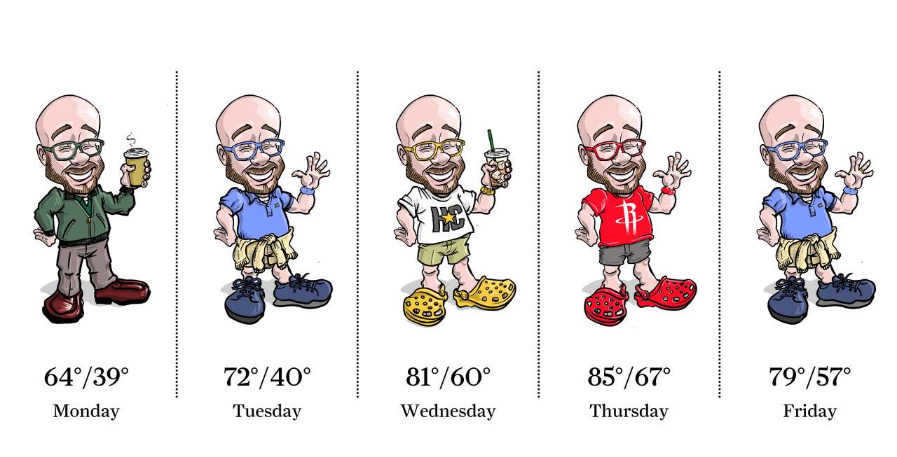
Photo by: Ken Ellis
We'll start this final week of February on a cool note, but daily temperatures quickly rebound to spring-like levels by the middle of the week. Peak afternoon temperatures that reach the 80s will arrive Wednesday and Thursday ahead of a weak (and dry) cold front.
| Ask a Meteorologist |
What does the end of La Niña mean for hurricane season? — Brad F.
After driving a warmer, drier winter in Houston, La Niña is weakening and expected to transition to a neutral phase by April, according to the National Oceanic and Atmospheric Administration.
Neutral conditions — when neither La Niña nor El Niño occurs in the eastern Pacific Ocean — are likely to last through most of the summer, overlapping with the June 1 start of hurricane season.
During La Niña, unusually cooler waters along the equator in the eastern Pacific shift global weather patterns, including those in Texas. As that influence fades, Southeast Texas could see a more typical spring pattern, with other factors like the Madden-Julian Oscillation and jet stream shifts playing a larger role in rainfall and storm activity.
Forecasters are calling for a 60% chance that El Niño develops by late summer or fall. El Niño often brings wetter and cooler winters to Texas and increases wind shear over the Atlantic, which can suppress hurricanes. However, forecasts made in spring face the "predictability barrier," meaning confidence remains limited.
For now, neutral conditions mean we have no strong Pacific signal to suppress or enhance storms. With Gulf waters already above average in temperature, the broader environment appears supportive of Atlantic hurricane development — though no outlook can predict landfalls months in advance.
READ MORE: La Niña set to fade before hurricane season. What does it mean for Texas?
Do you have a Houston weather or climate question? If so, you can submit your weather questions to justin.ballard@houstonchronicle.com. They may just end up in a future edition of the weather newsletter.
Something to see
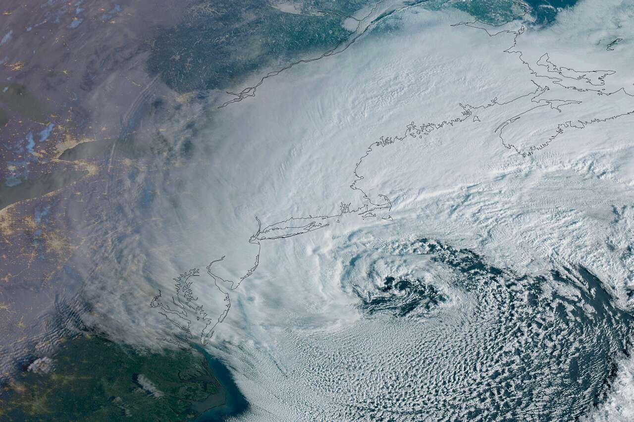
Photo by: Geostationary Operational Environmental Satellites, CIRA And NOAA
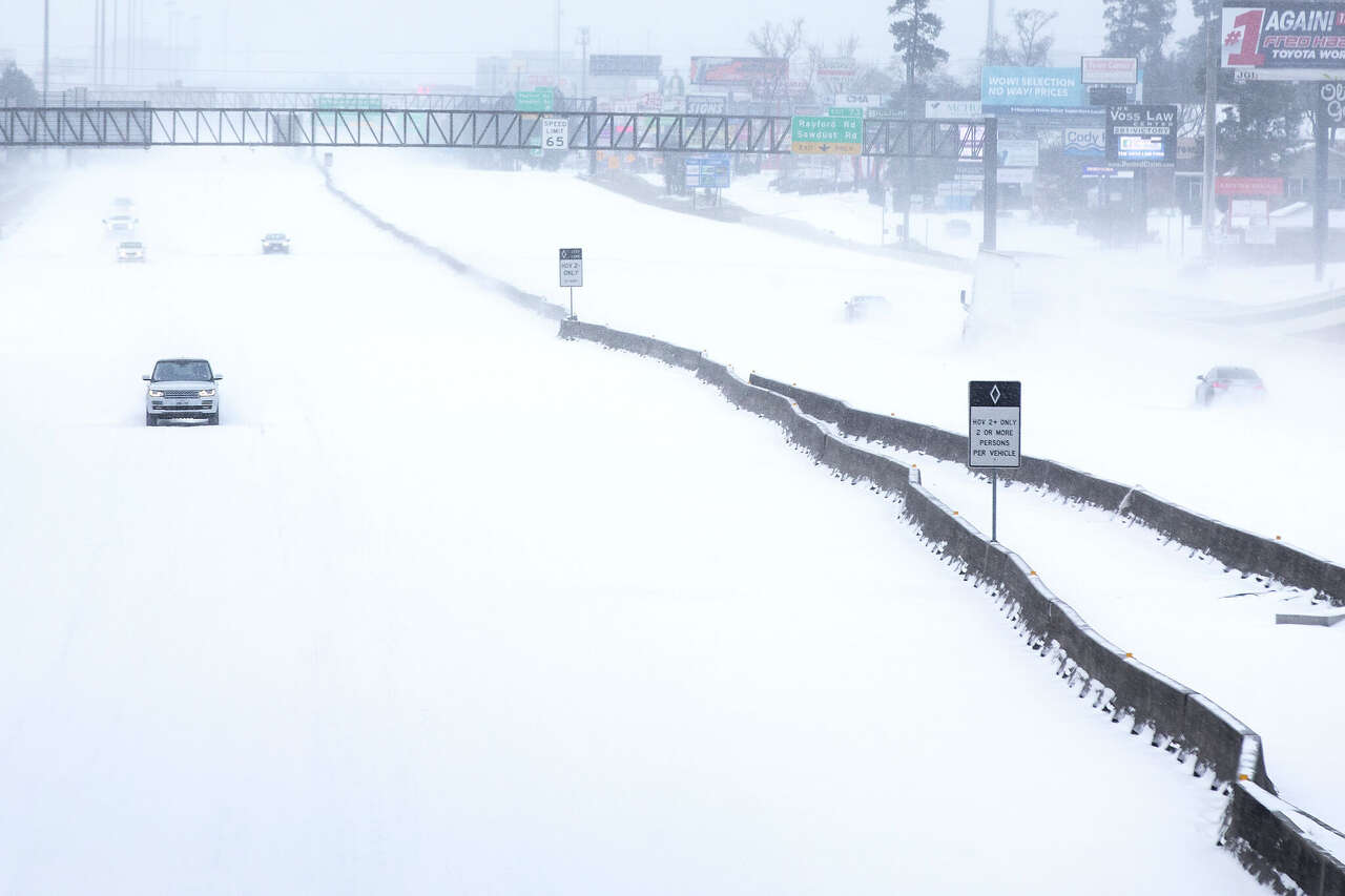
A major winter storm, seen here in a weather satellite photo taken just after sunrise Monday, bears down on New England and the northeastern United States, triggering blizzard and winter storm warnings along the Eastern Seaboard, from Washington, D.C., to Boston.
Texas Weather Wonks Trivia
As of Monday, February temperatures have been above normal so much in Houston that the average temperature for the month to date is 63.5, which is 6.3 degrees warmer than normal. What's the highest daily average temp for all of February in Houston? (Hint: The record was set in 2017.)
A) 67.8 degrees
B) 67.4 degrees
C) 66.6 degrees
D) 66.4 degrees
Hit reply to this email to let us know what your guess is and we'll let you know who answered correctly first in next week's newsletter.
Here's the correct answer to the previous weather trivia question: What's the highest amount of rainfall recorded for February in Houston? A) 9.8 inches in 1959.
Other weather news
|
|
|
|
Meet the Team

Photo by: Susan Barber
The 713 Weather Radar newsletter is written and produced by meteorologist Justin Ballard and Texas Weather Science Editor Roberto Villalpando. You can reach out to them at justin.ballard@houstonchronicle.com and roberto.villalpando@houstonchronicle.com or by replying directly to this email.
Recommended Reading
|
|
Unsubscribe | Manage Preferences

Houston Chronicle
4747 Southwest Freeway, Houston, TX 77027
© 2026 Hearst Newspapers, LLC


No comments:
Post a Comment